

WYOMING – The Wyoming State Geological Survey (WSGS) recently added new layers to its interactive Wyoming Geologic Hazards Map that make it easier to visualize radon potential throughout the …
This item is available in full to subscribers.
To continue reading, you will need to either log in to your subscriber account, below, or purchase a new subscription.
Please log in to continue |
WYOMING – The Wyoming State Geological Survey (WSGS) recently added new layers to its interactive Wyoming Geologic Hazards Map that make it easier to visualize radon potential throughout the state. Radon is a colorless, odorless, and tasteless radioactive gas that can build up to hazardous concentrations in enclosed spaces. Exposure to radon over time can cause lung cancer, and it is the second leading cause of the disease in the United States.
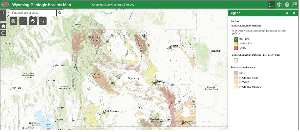
Radon gas comes from the natural decay of uranium, and it can emit from rock, soil, and groundwater. The radon layers displayed on the WSGS online map show locations where radon occurrence may be elevated due to geologic conditions. These layers were created using data from a previous WSGS publication and observation statistics provided by the Wyoming Department of Health.
“The radon statistics provided by the Wyoming Department of Health are central to the utility of these new map layers,” says Dr. Erin Campbell, WSGS Director and Wyoming State Geologist. “We are pleased to collaborate with the Department Health to create an impactful product that makes it easier to assess radon potential across Wyoming.”
Test results have shown elevated radon levels in all 23 of Wyoming’s counties, though radon concentration can vary widely from building to building due to local and non-geologic factors. Areas not depicted on these map layers may have high potential for radon, and not all portions of depicted areas will have high radon levels. The only definitive way to evaluate radon exposure is to have site-specific testing done in the building.
“Radon is one of Wyoming’s most widespread, yet often underappreciated, geologic hazards,” says WSGS hazards geologist James Mauch. “These new layers are meaningful additions to the online map, and we hope they raise awareness about the need for Wyoming residents to have their homes tested for radon.”
The U.S. Environmental Protection Agency recommends mitigation of buildings if an indoor radon concentration tests at or above 4.0 picocuries per liter (pCi/L) and to consider mitigation for concentrations between 2.0 and 4.0 pCi/L. The Wyoming Department of Health offers free and discounted at-home radon test kits for Wyoming residents. Visit the Wyoming Radon webpage at health.wyo.gov/radon for more information.
The Wyoming Geologic Hazards Map also features layers about earthquakes, landslides, faults, expansive soils, and windblown deposits. Staff update the online map routinely as new information and data become available.


